Our Solutions
01
Remote Sensing & Downstream Space
Advanced analysis and interpretation of satellite imagery and aerial data
The SAT4ΦOREST project aims to develop an integrated satellite-based monitoring service for the protection and sustainable management of Greece’s forests. By leveraging data from the National Microsatellite Constellation, the project provides real-time and
Hellenic Space Dawn: Selene & Helios: Geosystems Hellas (GSH) together with EMTEC Space P.C., ISD S.A., ΗΕRON Engineering, LEO Photonics, AUTH, UoA and HNA, are creating the first Greek CubeSat twin constellation SELENE and HELIOS (CubeSat for Earth
European Sensor Systems S.A.: Supply of software in the context of the development of an observatory system for integrated management of the coastal zone with remote sensing data for the Region of Central Macedonia. More specifically, supply and installation
DRIC-DEFKALION: GSH leveraged its expertise in GIS, remote sensing, and disaster risk management to showcase solutions, identify synergies, and contribute methodologies that enhance the cluster’s disaster resilience
2012-13 : Technological Educational Institute of Kavala: Supply of equipment and software and creation of a web content management system under the Action “Educational approach to natural disasters in the aspect of digital
2012 : The company is implementing SmartPlant technology for the coal mine of Megalopolis for PPC, optimizing design, engineering, and data management processes. This project enhances operational efficiency, safety, and sustainability through advanced digital
01
Photogrammetry & Aerial Mapping
Utilization of superior sensors imaging the Earth to extract information and spatial data
2024: Hellenic Military Geographical Service (HMGS): GSH, in collaboration with COSMOS , carries out the project “Digitization of the Chronological Archive of Aerial Photographs of the Hellenic Military Geographical Service – Development and Provision of
2021: maintenance of the Leica DSW700 photogrammetric scanner at the Hellenic Military Geographical Service (HMGS) facilities. This service ensured the scanner's optimal performance for high-precision aerial film
2021: Austrian Archaeological Institute: 3D mapping of the wider area of the archeological site of Aigeira. More specifically, 3D imaging with LiDAR system and aerial photography and produced as final products: orthophotos and orthomosaic of very high
2017-2018 : The company conducted LiDAR and 10 cm resolution RGB aerial mapping for road construction projects in the Republic of Moldova, in collaboration with Obermeyer. This initiative provided precise topographic data to support infrastructure
2015 : 10cm RGBNIR airborne Stereo Imagery Coverage and processes for the Integrated Information System for the Promotion of Cultural and Tourist Product of the Ionian Region, Islands using Information Technology and Communications, of the Operational
2014 : Geological Survey Department: InSAR Time Series with Atmospheric Estimation Model (InSAR TS + AEM), Pafos District, time series SAR images
2013 : The company supplied the Department of Lands and Surveys, Cyprus Ministry of Interior, with Hexagon Geospatial Photogrammetry Lab Software. This implementation enhanced the department's capabilities in processing and analyzing geospatial data for land
01
WebGIS Platform
Development and implementation of intergraded hardware and GIS solutions for spatial data management and visualization analysis
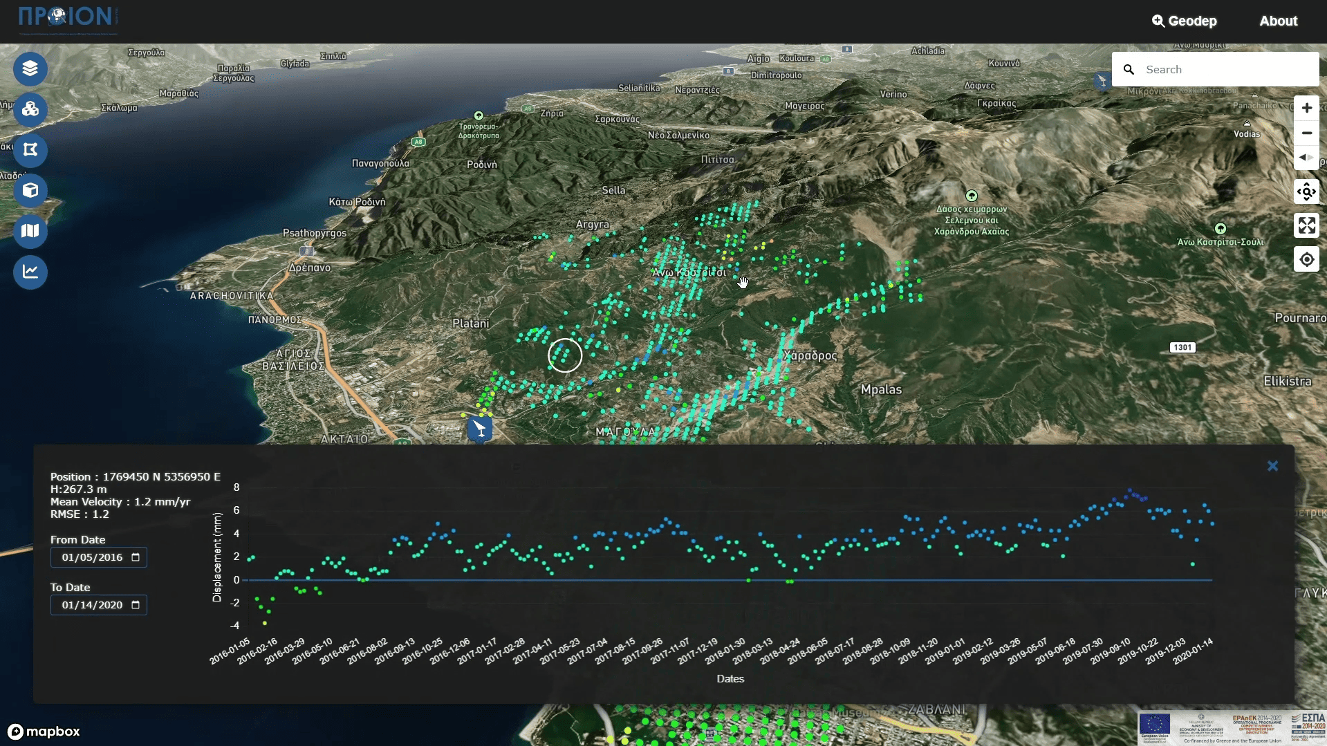
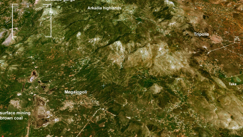
2021: MANAGEMENT BODY OF EVROS DELTA AND SAMOTHRAKI PROTECTED AREAS: Development of Information System for Documentation Recording and Analysis of Spatial Data and Mapping of the Evolution. In particular, in the first part of the contract, the software for
2014-2015 :upgraded the geoportal and implemented Geographic Information Systems for the Region of Crete. This project enhanced spatial data management and accessibility for regional planning and
2014 :Universita degli Studi di Napoli Federico II Napoli: FORMAZIONE CARTA TECNICA IN FORMA DIGITALE DELL’ ISOLA DI SANTORINI
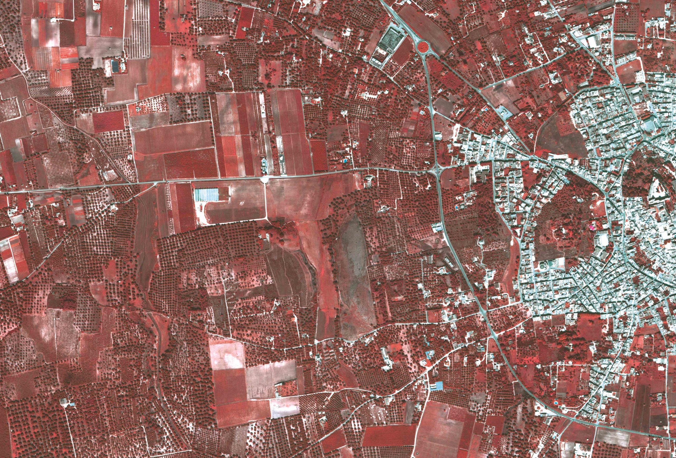
2013-15: MOA Greek Payment Authority of Common Agricultural Policy (C.A.P.) Aid Scheme, participation to : a) OPS 302037, Lot 7: Integrated Mapping System with production and use of the country coverage of soil maps & b) OPS 302037, Lot 6: Remote Sensing and
2012-13 : Bathymetric GIS maps for Greece and Mediterranean Region, for the Creation of Application and Supply of Equipment for the Interconnection of a Fisheries Monitoring Center for the PORT AUTHORITY BODY via COSMOS BUSINESS
Geosystems Hellas Products
We encourage you to contact us at sales@geosystems-hellas.gr and discover how our advanced geospatial solutions can transform the way you work.
