Skip to content Skip to footer

Leica CountryMapper Hybrid Airborne Sensor

Leica CountryMapper Hybrid Airborne Sensor

Leica CountryMapper is a hybrid airborne sensor for large-area mapping.

It combines a large-format photogrammetric camera with a high-performance LiDAR unit in one system. This allows users to collect accurate image data and LiDAR data at the same time.

The sensor is designed for large-area airborne mapping projects. It supports the production of both 2D and 3D geospatial data products.

Leica CountryMapper helps organisations create accurate base maps, orthophotos, point clouds and 3D mapping products. This makes it suitable for national mapping, regional mapping and large infrastructure projects.

The system also integrates with Leica HxMap. This creates an end-to-end workflow for image and point cloud processing.

Leica HxMap supports distributed processing. As a result, users can manage very large datasets more efficiently and improve overall productivity.

Key Benefits

  • Hybrid imaging and LiDAR data collection
  • Large-format photogrammetric camera
  • High-performance LiDAR unit
  • Simultaneous 2D and 3D data capture
  • Suitable for large-area airborne mapping
  • Integration with Leica HxMap
  • Efficient processing of large datasets

Applications

Leica CountryMapper can support:

  • Large-area airborne mapping
  • National and regional mapping
  • Orthophoto production
  • Point cloud generation
  • 3D geospatial data production
  • Infrastructure mapping
  • Land management
  • Environmental monitoring

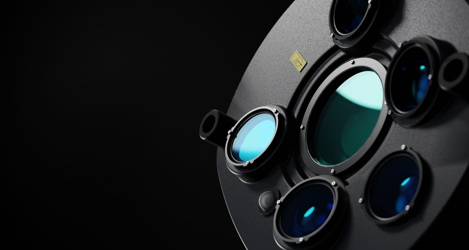
High-resolution camera

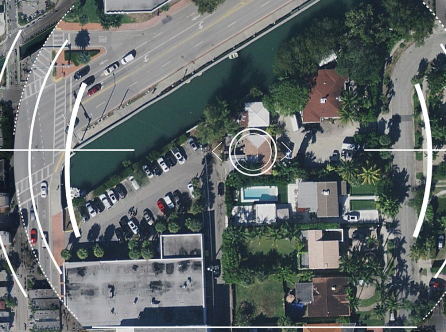
With over 31,000 pixels across the swath, the camera system provides superior collection efficiency for large-area coverage. CMOS-based Leica MFC150 camera modules leverage true mechanical forward-motion-compensation (FMC) to deliver industry leading image quality, even at faster aircraft speeds and in challenging lighting conditions.

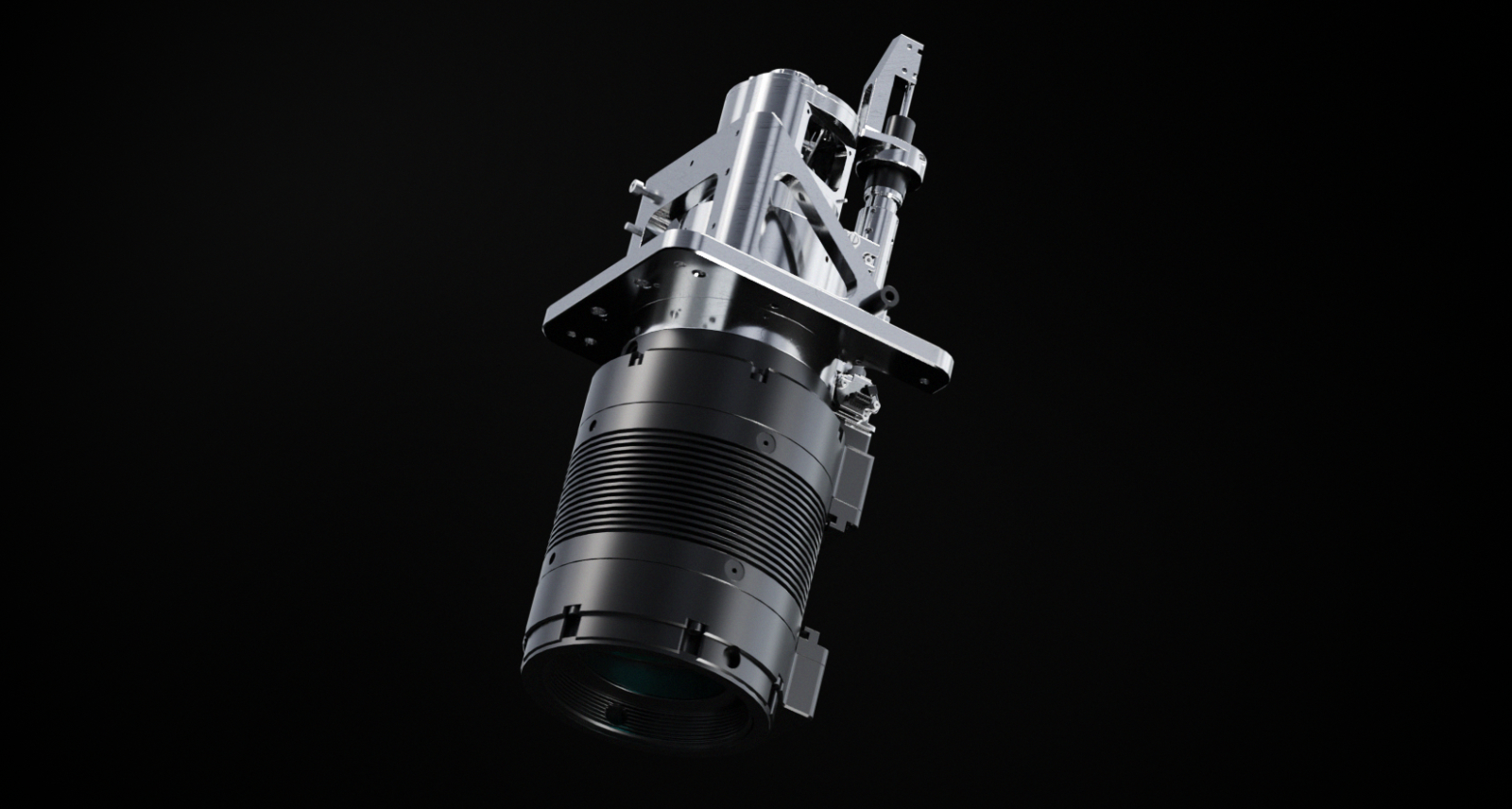
Full performance LiDAR unit

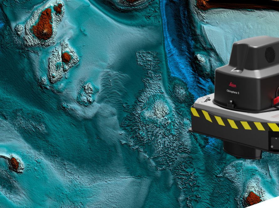
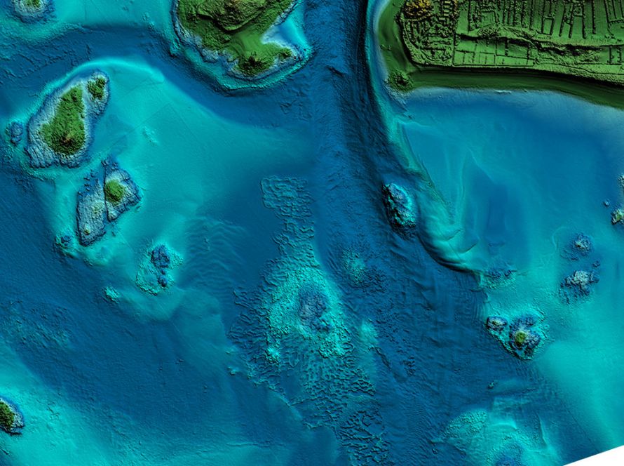
The CountryMapper features the new Hyperion3 LiDAR unit that, with a 60 degrees field of view, significantly improves the performance and flexibility of the system compared to previous generations. Operating at a pulse rate of 2 MHz, the LiDAR module provides reduced laser divergence, enabling greater planimetric accuracy and better foliage penetration.

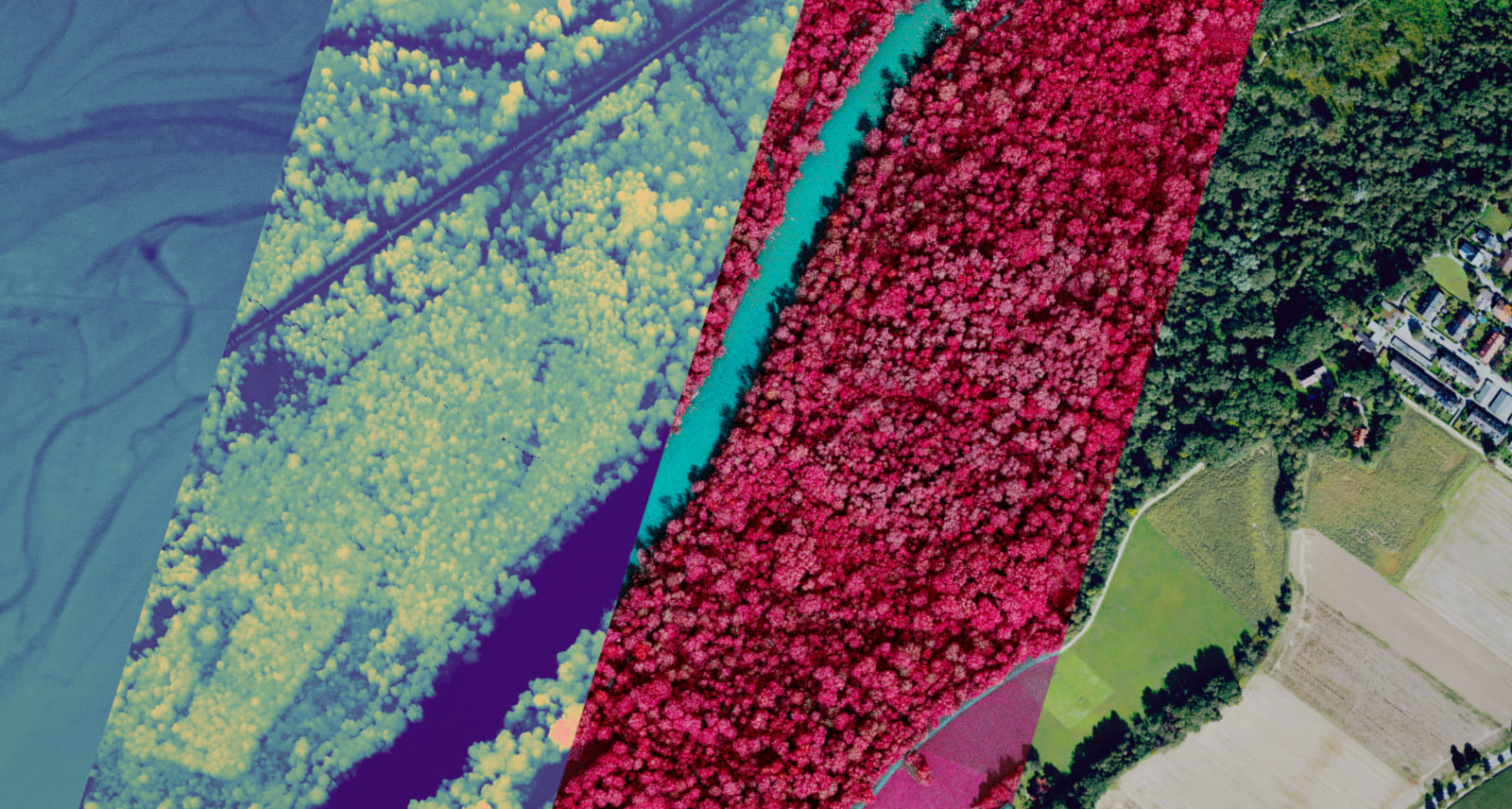
Foundational Geospatial Data

The sensor enables simultaneous collection of aerial images, LiDAR point clouds, DSM and DTM in just one flight. Matching camera and LiDAR modules provide superior geometric and temporal data consistency to support applications such as orthophoto generation, terrain mapping, hydrography, forestry monitoring and infrastructure management.

Data Sheets

Watch the on-demand webinar to learn more about the benefits of the new hybrid sensor

Skip to content