The “Golden Twins” project under ESA’s InCubed program, aims to establish a system-agnostic, multi-mission hosting Earth Observation (EO) platform addressing the unique challenges of Greece’s islands. Focused on forest fire…

The NeAIxt project aims to help Europe lead the development and industrialization of key Edge AI technologies by combining advanced microelectronics, embedded artificial intelligence, and security.
Addressing critical challenges such as population displacement due to conflicts, exacerbated by factors like climate change, extreme weather events, food shortages, and poverty, remains paramount.
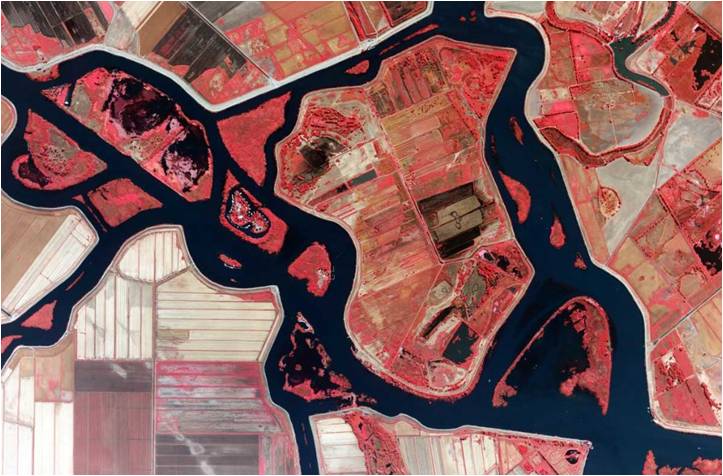
Coastal regions are considered pivotal for socio-economic activities facing heightened vulnerability to Climate Change (CC). The imperative for CC adaptation in coastal zones is evident and is expected to be…
The EU has experienced a surge in fixed border surveillance solutions, including physical barriers, now covering 13% of its external land borders. The BorderForce project addresses evolving threats by enhancing…
The TRIQUETRA project aims at creating an evidence-based assessment platform that allows precise risk stratification, and also creates a database of available mitigation measures and strategies, acting as a Decision…
The project aims to detect the pre-visual stages of infection of olive trees affected by the bacterium Xylella fastidiosa (Xf) using satellite data and Remote Sensing technics. With the use…
The present project proposes an application aiming at the improved quality of potato production through more efficient absorption of nutrients, a pro-environmental management of important fungal pathogens ofthe crop by…
Urban areas are currently facing significant new and/or aggravated existing challenges due to the impacts of climate change, including increased frequency and intensity of extreme weather events, urban greenness loss,…
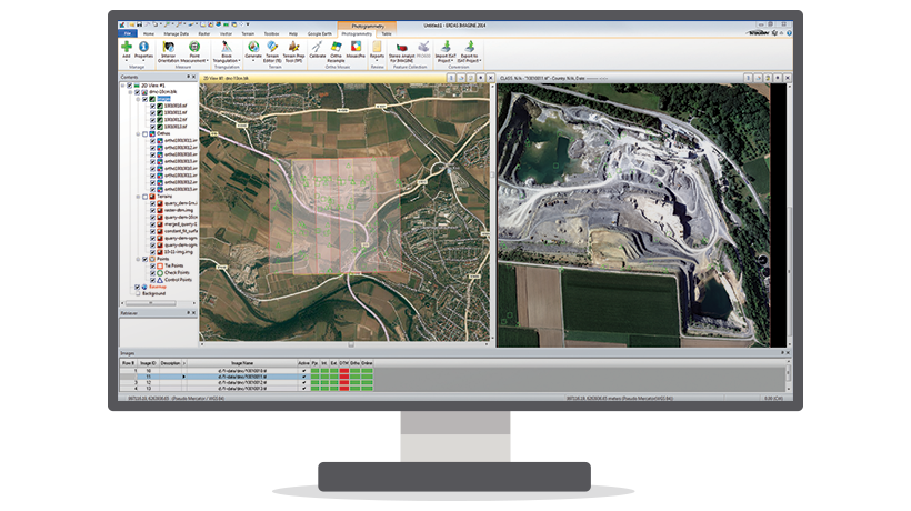
IMAGINE Photogrammetry is an integrated collection of software tools which enable the user transform raw imagery into reliable data layers required for all digital mapping, raster processing, GIS raster analysis,…
Geomedia WebMap enables direct creation of interactive web maps by using the configuration and application creation tools provided in GeoMedia itself, eliminating the need for programming. Configure the layout of…
Geospatial Portal is a browser-based, multilingual web application that can be used for finding, viewing, querying, analyzing and consuming geospatial data and web services published by other Hexagon Geospatial solutions…
Mobile MapWorks Essentials enables you to use your mobile tablet to update your GIS directly from the field. Downloadable as an iOS, Android™ and Windows app, field personnel can use…
Geospatial SDI is an interoperable and scalable spatial data infrastructure designed for data providers that need to manage and serve secure or licensed information using standards-based web services. It offers…
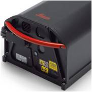
An economic LIDAR system capable of meeting your present and future needs as it is fully upgraded.
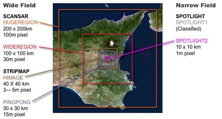
The COSMO-Skymed system consists of four radar satellites for Earth observation. Its purpose is to monitor and provide data on a global scale for commercial and scientific purposes and also…