Access high-quality satellite imagery for faster, smarter decisions.
Geosystems Hellas provides reliable satellite imagery solutions for urban planning, infrastructure development, disaster response, agriculture, and environmental monitoring. With access to high-resolution satellite data and global coverage, we help organizations, businesses, and public authorities find the right imagery for every project.
What Is Satellite Imagery?
Satellite imagery consists of images captured by satellites orbiting the Earth at specific dates and times. These satellites use advanced sensors to record electromagnetic radiation reflected from the Earth’s surface. Since each material reflects energy differently, satellite imagery can reveal valuable information about land, water, vegetation, infrastructure, and environmental change.
Our Satellite Imagery Categories
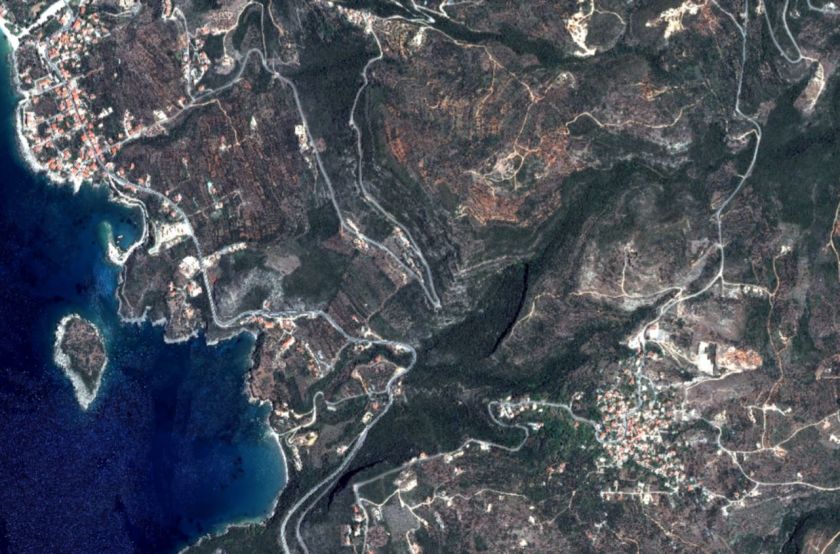
Very High-Resolution Imagery (≤ 0.5 m)
Ideal for projects that require maximum detail and precision, including:
- Detailed mapping and geospatial analysis
- Infrastructure and asset monitoring
- Agriculture and environmental applications
- Emergency response and disaster assessment
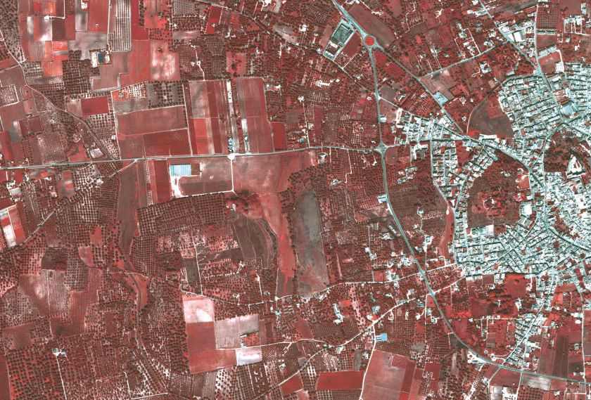
High-Resolution Imagery (0.6 m – 0.8 m)
Suitable for monitoring land and urban areas with strong detail, supporting:
- Urban development and planning
- Infrastructure tracking
- Land cover analysis
- Disaster management
- Environmental monitoring and urban expansion studies
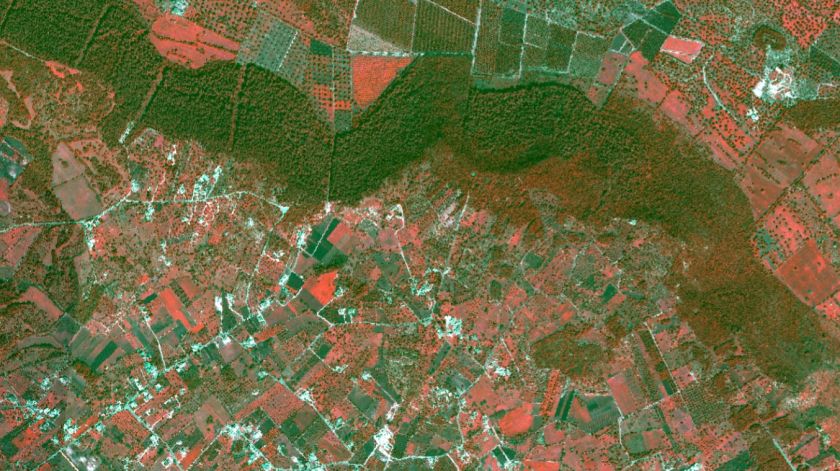
Medium-Resolution Imagery (≥ 1.5 m)
Best for large-area coverage and regional assessments, such as:
- Agricultural and forestry monitoring
- Climate and environmental observation
- Large-scale land management
- Long-term change detection
Why Choose Geosystems Hellas?
- Access to advanced satellite imagery with high accuracy and frequent updates
- Tailored solutions based on your sector and project requirements
- Expert guidance to help you choose the right imagery product
- Easy ordering process with a minimum area of 25 km²
- Trusted geospatial expertise and customer support throughout the process
How to Order Satellite Imagery
To prepare your custom satellite imagery request, please send us the following:
Area of Interest (AOI)
Upload or define your selected area using a polygon file such as KML or SHP.
Spatial Resolution
Choose the required pixel size depending on the level of detail you need.
Spectral Bands
Select the bands required for your application. RGBNIR can be included when needed.
Acquisition Date Range
Specify your preferred date or time period for image capture.
Processing Level
Choose the image format you need, such as Bundle or Pansharpened.
Request Your Satellite Imagery Today
Geosystems Hellas makes it easy to order satellite imagery tailored to your project needs. Our team will help you identify the right data solution for accurate, efficient, and cost-effective results.
Contact Geosystems Hellas for more info:
+30 210 2846144-145
mail@geosystems-hellas.gr