Skip to content Skip to footer

Meet Our People

Vasiliki (Betty) Charalampopoulou
President & CEO

Vasiliki (Betty) Charalampopoulou is GEOSYSTEMS HELLAS S.A. [GSH] President & CEO and a shareholder. [Betty is a geologist, with a specialization on remote sensing, photogrammetry and GIS applications.

In 1992, she graduated from the National and Kapodistrian University of Athens and since then, she has been working on research projects in the area of photogrammetry, remote sensing, earth observation and geoinformatics (GIS and WebGIS). She is actively enrolled in projects by Horizon Europe, H2020, ESA, GSRT and bi-National and in several commercial ones with a dynamic participation to the downstream space sector. Have several collaborations with national and international universities, local governments and industries.

As CEO and President, she has established methodologies and formulated strategies, gaining many distributions and collaborations. In 2012, she established the company’s R & D division and had Successful R & D projects under her supervision, with transferability to many industries and countries. She is also responsible for the distribution of roles and responsibilities in the company. She has also established several international collaborations, being involved in working groups of EARSC, GEO, FIG, UNESCO, OGC, ESA, NASA, ISA etc.

Betty is an elected Director of the European Association of Remote Sensing Companies (EARSC), EARSC representative in the GEO Post-2025 Working Group, is also elected in the board of the Hellenic Association Space Industry (HASI) and the board of the si-cluster in which acts as Technical Director for SPACE 4.0. Betty is the ELOT “Expert – Greece” at the ISO TC20 /SC14 /WG 8 Downstream standardization for Space Services & Space-based Applications Group.

Christos Kontopoulos – CTO

Christos received his diploma from National and Technical University of Athens (NTUA) – School of Rural & Surveying Engineering. His main research interests and areas of specialization lie in the fields of Earth Observation and remote sensing, GIS, photogrammetry and geospatial data analysis. He has been enrolled in several research projects and research teams, in the aforementioned domains while also presenting a great experience on photogrammetric, LIDAR data analyzing, cadastre and satellite data exploitation projects.

His main expertise also include the development of Machine Learning and Deep Learning models for EO data classification and pattern recognition techniques. He has also been involved in several other commercial projects, as a remote sensing and photogrammetry specialist, dealing with the processing and the analysis of multispectral and hyperspectral optical data, UAV data as well as LIDAR and SAR data. Christos embraces the philosophy of high Technology and AI at every step of the company to the future.

Eirini Marinou – Project Manager

studied at the National and Kapodistrian University of Athens, in the department of Geology and Geo-environment. During her bachelor degree she completed her Bachelor thesis with the title “Geo-radar measurements to accurately locate misshapen linear targets”. Having completed her BSc studies, her MSc degree followed in Utrecht University in the program “Earth Structure and Dynamics” and more specifically in the “Physics of Deep Earth and Planets”. The title of her thesis is “Spectral Element Method used in radar modeling for asteroid imaging application”. Although she obtained a MSc degree in geophysics, she has a special interest in Remote Sensing applications. She has taken part in several research programs within her internship, both at undergraduate and postgraduate level. She has been working at Geosystems Hellas since 2022.

Adamantini (Mandy) Patoulia – Project Controller

With over 20 years of professional experience in Fintech, she has primarily worked within Greek banks and collaborated with multinational companies, cultivating expertise in developing and promoting both physical and digital retail banking products. Her skills extend to targeting and creation of action and sales plans, team management, and partner relationship management. In recent years, she has held key roles with a focus on customer loyalty programs, customer experience, and agile project management. Her project management involvement spans project programming, business processes, and portfolio management. A graduate in Marketing from Ulster University, UK, she furthered her qualifications with a certification in Advanced Project Management from the National and Kapodistrian University of Athens in 2020. She has been working at Geosystems Hellas since December 2023.

Lina Karagianni – Geoinformatics Engineer, Hexagon Geospatial Solutions Sales & Technical Support

is a graduate of the School of Rural and Surveying Engineering of the National Technical University of Athens and she has completed her postgraduate studies through the Department of Geoinformatics of the National Technical University of Athens. As part of her master’s thesis, she created online maps to visualize the content and discussions that take place in social media. Her interests are in the management, analysis and visualization of geospatial information. She has been working for Geosystems Hellas since 2023.

Polychronis (Pol) Kolokoussis – Project Manager AI & Data Analysis

holds a Diploma in Rural and Surveying Engineering from NTUA (1993) and a PhD Degree in Remote Sensing from NTUA (2008). His research interests and areas of expertise include: Multispectral, hyperspectral, thermal, SAR, LiDAR etc sensors and (satellite, aerial, ground and underwater) platforms/systems. Acquisition and processing of remote sensing imagery emphasizing in methods and techniques for various applications like change detection, modeling of phenomena, risk assessment for natural hazards and the protection of the natural environment. Development of algorithms and methods for the analysis of remote sensing imagery as well as their integration with GIS. He has shown special interest and has long experience on processing multispectral/ hyperspectral and other remote sensing imagery using machine/ deep learning techniques, object based image analysis and their integration, while he is also experienced in cloud computing and the development of WebGIS applications. He has published his work in several international journals and conferences, and has participated in more than twenty five National and European Research Projects. He is reviewer in a range of international journals of Elsevier, IEEE, MDPI, Wiley, Springer and Sientific Research Publishing as well as evaluator of FP7 and H2020 Earth Observation proposals. He is working at Geosystems Hellas since March 2023.

Efthymios Magkoufis – Geoinformatics & Geospatial Software Engineer

has graduated from the School of Rural, Surveying and Geoinformatics Engineering of National and Technical University of Athens (NTUA). His main interests lie in the fields of geoinformatics, geospatial data analysis and Web-GIS applications development. He has been working at Geosystems Hellas since 2022.

Anastasia Anastasiou – Geoinformatics Engineer, Photogrammetry Expert

holds a Diploma of Rural and Survey Engineering from the National Technical University of Athens. She also holds a master’s degree from the programme “Protection of Monuments” at the School of Architecture of the National Technical University of Athens. She has been involved in the EU project “Hyperion: Development of a Decision Support System for Improved Resilience & Sustainable Reconstruction of Historic Areas to cope with Climate Change & Extreme Events based on Novel Sensors and Modeling Tools” and a series of projects assumed by the Photogrammetry Laboratory of the School of Rural and Surveying Engineering of NTUA as a researcher with the object of the geometric documentation of monuments. She has experience in the field of geometric documentation of monuments, using both geodetic and photogrammetric techniques. More specifically, she has volunteered as an on-site survey engineer at Tenea Project, the excavation project of ancient Tenea taking place in Chiliomodi, Corinth for five consecutive years (2018-2022).

Giorgos Voskopoulos – Software Engineer

is a graduate of Accounting & Finance from the School of Management & Economics of TEI Piraeus and a final-year student in Information Technology and Computer Engineering majoring in Software at the University of West Attica. He has been working at Geosystems Hellas since 2022.

Konstantinos Apostolopoulos – Geoinformatics Engineer, Senior Project Manager

is a Ph.D. candidate at the School of Rural and Surveying Engineers-Surveying Engineering & Geoinformatics(SRSE-GI), NTUA(2017-present), a scholar of the Eugenides Foundation (2017-2019), and holds an MSc in Geoinformatics from the SRSE-GI, NTUA(2015, with distinction). He is a graduate of the SRSE-GI,NTUA(2014). His doctoral thesis focuses on introducing new tools and institutional procedures into cadastral surveying. He provides assistant teaching in the undergraduate program of the SRSE-GI, NTUA(2017-present) as well as in the MSc program of Geoinformatics (2016-present). His research interests include Cadastre, Land Management, Crowdsourcing, Participatory Design, Gamification Tools, Geoinformatics, Property Evaluation and Sustainable Development. Author in scientific journals in peer-reviewed journals and international conferences. He has volunteered in the organization of seminars, workshops, and international conferences. He has participated in commercial and research projects in the fields of Geoinformatics, Cadastre, and Land Management. He has been a member of the Technical Chamber of Greece since 2014 and a member of scientific committees of the Technical Chamber of Greece, the Ministry of Environment and Energy, and the Ministry of Rural Development, as well as the International Federation of Surveyors (FIG), where he is active incommittees3 (spatial information management) and 7 (Cadastre and land management).

Anna Papadima – Surveying Engineer, Junior Analyst

has graduated from the School of Rural, Surveying and Geoinformatics Engineering of National and Technical University of Athens (NTUA) and now she is completing her post-graduate studies in the MSc Urban and Regional Planning also in NTUA. Her main interests lie in the fields of geospatial data analysis in GIS, urban planning and the applications of Machine Learning with the use of Artificial Neural Networks. She has been working at Geosystems Hellas since 2023.

Aleksandros Kostaras – Geoinformatics Engineer

has graduated from the School of Rural and Surveying Engineering of Aristotle University of Thessaloniki and holds an MSc degree in “Applied and Environmental Geology and Geophysics from the department of Geology of University of Patras. He has been working within the international program Copernicus Land Monitoring Service about the environmental Land Cover Study using satellites and other datas. Attendance as Field Data Surveyor to Lucas Survey of Eurostat for the years 2015, 2018 and 2022. Plus, he worked for the assessment of Natural Hazards in the territory of the Prefecture of Attica designing and digitalizing of the road network and spatial planning of land uses. Furthermore, he has participated in the study of Cadastral surveying for the creation of a National Land Registry in the remaining areas of the regional units of Evrytania and Fthiotida ΚΤ5-13 (2018-2021), of the Region of Central Greece. He has been working at Geosystems Hellas since 2023.

Olympia Kourounioti – Project Manager at Photogrammetry Division

holds a degree from the School of Rural and Surveying Engineers – Department of Geomatics Engineering and Geoinformatics from the National Technical University of Athens with a specialization in Photogrammetry. Additionally, she has obtained a postgraduate diploma in “Artificial Intelligence and Visual Computing” from the University of Western Attica and the University of Limoges. Furthermore, she is a prospective Ph.D. candidate at the Geospatial Technology Laboratory of the University of Western Attica, focusing on the processing and fusion of multispectral, hyperspectral aerial, and satellite images using engineering techniques, deep learning, and remote sensing methods. She, also, participated as a researcher in the European project “Multiscale Sensing for Disease Monitoring in Vineyard Production.” They have professional experience in surveying, photogrammetric representations, as well as in the management and organization of projects related to Geographic Information Systems. She has been working at Geosystems Hellas since 2023. 
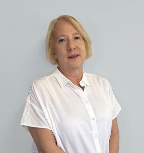
Giannis Karaparisis – Geoinformatics engineer

graduated from the School of Production Engineering and Management at the Technical University of Crete. Currently, he is pursuing post-graduate studies in the MSc program ‘Mathematical Modeling’ at the National Technical University of Athens. His primary interests revolve around data science and neural networks. He has been working at Geosystems Hellas since 2023.
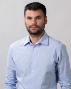
Konstantinos Mpotonakis – Geoinformatics Engineer

is currently studying at the School of Rural and Surveying Engineering and Geoinformatics of the National and Technical University of Athens, preparing his thesis in the field of InSAR technology. His main interests are in the areas of data analysis, web development, remote sensing, photogrammetry and GIS. In 2023 he completed his internship at Geosystems Hellas as a junior software developer, dealing mainly with spatial data visualization. He joined Geosystems Hellas in 2024.

Mariana Mandilara – GIS Junior Engineer

graduated from Aerospace Science and Technology of National and Kapodistrian University of Athens. Her main interests lie in the fields of remote sensing, Geographic Information Systems (GIS) and environmental data analysis. She conducted her intership in Geosystems Hellas as a remote sensing analyst in 2023 and has been working at Geosystems Hellas since 2024.

Lysander Giannikas – GIS Specialist

is a Geographer specializing in geoinformatics and area mapping. In 2003 he conducted his internship in engineering company “ANYSMA SA”. The scope of his work included digitization of elements from aerial photographs for the national land registry. He has worked in engineering and construction companies as well as the Technical Service of a Municipality. He has been working at Geosystems Hellas since 2023.

Thomas Papakosmas – EO Project Manager

is a Physicist with a diploma from National and Kapodistrian University of Athens (NKUA) since 2018, and also holds an MSc in ”Environment and Development of Mountain Regions” from the National and Technical University of Athens (NTUA) since 2021. His main research interests lie in remote sensing and GIS applications and geospatial data analysis. He has been working at Geosystems Hellas since 2021.

Besjan / Ioannis Bici – Geoinformatics engineer

is currently pursuing their undergraduate studies in the School of Rural, Surveying, and Geoinformatics Engineering at the National Technical University of Athens . He completed his internship in 2023 as a Remote Sensing Analyst and he possesses a strong interest in the fields of remote sensing and GIS and are dedicated to deepening their knowledge in these areas. He has been working at Geosystems Hellas since 2023.

Maria Katsikovordou – Public Relations and Communications Εxpert

is a Public Relations and Communications expert with an extensive background in Corporate and Political Communication, Media Relations & Journalism. She has worked in the private sector, in top tier Communications agencies and media networks in Athens, handled projects in Cyprus and has worked in Poland for a short time as a Journalist with Greek language, for Greek and Cyprus markets. She holds a Bachelor degree from the American College of Greece, Deree, majoring in Marketing Management, a Masters in International Public Relations from Cardiff University, School of Journalism, Media & Cultural Studies, has certifications from various seminars and workshops by Institute of International Relations, Institute of Diplomacy & Global Affairs ACG, Hellenic Institute of Communication while attended a summer School in Journalism at London School of Economics and Political Science. Maria enjoys working on multinational projects and cooperating with diverse groups of colleagues from different countries and cultural backgrounds. She believes in human aspect and emotional intelligence as a way of solving issues in today’s complex disruptive environment and trusts dialogue as a means of negotiations, conflict resolution and progress. She has been working at Geosystems Hellas since 2024.

Despina Syriopoulou – Business Development Manager

is a journalist, for over 25 years -most of them based in New York City as United States correspondent for Greek media online and printed outlets. Despina  worked at the private sector, both in the USA and Greece, in the field of communication, consulting, research and analysis. She holds a bachelor degree in ancient Greek and Latin Literature, University of Ioannina and a Masters in International Relations, New School University. She has been working for Geosystems Hellas, since May 2024.  

Maria Kontostergiou – Geoinformatics Engineer

is a Surveyor and Geomatics Engineer, specialized in Geographical Information Systems. Also, her field of expertise and main interests lies on Photogrammetry and digital image processing and Applications of remote sensing in map construction too. She has been working at Geosystems Hellas since 2023.

Nikos Fragkos – Junior Geospatial Engineer

is currently studying in the School of Rural, Surveying and Geoinformatics Engineering of National and Technical University of Athens. His main interests lie in the fields of earth observation and Remote sensing, photogrammetry and GIS. In 2022 he conducted his internship in Geosystems Hellas as technical staff, participating in earth observation projects and creating maps. He has been working at Geosystems Hellas since 2023.
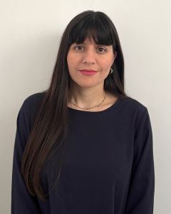
Sofia Fidani – Sales Associate

is an agronomist with specialization in food technology. She graduated from Democritus University of Thrace in 2012 and holds an MSc in Sustainable Management of the Environment and Natural Resources (Direction: Sustainable Management of Mountainous Watersheds with Intelligent Information Systems and GIS) from the same University. Her field of expertise and main interests lie in geoinformatic applications. Since 2014 she has been working at Geosystems Hellas as a marketing/client manager and technical support operator in geoinformatics, from 2022 she is working as a sales manager and recently she became an Associate. 

Giorgos Daskalopoulos – Communication Expert, Senior Analyst

is a Communication and Marketing Specialist. He earned his bachelor’s degree in Economic Science from Panteion University and holds a master’s degrees in Marketing from Strathclyde University in Glasgow, United Kingdom.Through work experience as a communication specialist and communication manager for two NGO’s, he specializes in creating persuasive copy for websites, emails, print advertisements, press releases as well as in using integrated digital tools such as email, social media platforms, website etc. to communicate the main purpose of the organisation. He has been working at Geosytems Hellas SA since 2023 and is responsible for the company’s communications activities.

Chrysa Arsenaki – Marketing & Accountant Assistant

graduated from the AKMI Vocational Training Institute in 2020 as an Animation Technician – Electronic Graph Designer. She specializes in Autodeck 3D Max and other graphic programs. She has been working at Geosystems Hellas since April 2021.

Avgerinos Tegopoulos – Software Engineer

Graduated from the University of Reading with a degree in Computer Science. Specializes in frontend design and web development, with experience in Unity Engine, Game Design and machine learning. He has been working at the Geosystems Hellas since 2024.

Contact info

Contact info

Follow us

#earthobservation #geospatial #GEOINT #geosystemshellas

Privacy Policy

  2024 by  BWEBNET

Vasiliki (Betty) Charalampopoulou
President & CEO

Vasiliki (Betty) Charalampopoulou is GEOSYSTEMS HELLAS S.A. [GSH] President & CEO and a shareholder. [Betty is a geologist, with a specialization on remote sensing, photogrammetry and GIS applications.

In 1992, she graduated from the National and Kapodistrian University of Athens and since then, she has been working on research projects in the area of photogrammetry, remote sensing, earth observation and geoinformatics (GIS and WebGIS). She is actively enrolled in projects by Horizon Europe, H2020, ESA, GSRT and bi-National and in several commercial ones with a dynamic participation to the downstream space sector. Have several collaborations with national and international universities, local governments and industries.

As CEO and President, she has established methodologies and formulated strategies, gaining many distributions and collaborations. In 2012, she established the company’s R & D division and had Successful R & D projects under her supervision, with transferability to many industries and countries. She is also responsible for the distribution of roles and responsibilities in the company. She has also established several international collaborations, being involved in working groups of EARSC, GEO, FIG, UNESCO, OGC, ESA, NASA, ISA etc.

Betty is an elected Director of the European Association of Remote Sensing Companies (EARSC), EARSC representative in the GEO Post-2025 Working Group, is also elected in the board of the Hellenic Association Space Industry (HASI) and the board of the si-cluster in which acts as Technical Director for SPACE 4.0. Betty is the ELOT “Expert – Greece” at the ISO TC20 /SC14 /WG 8 Downstream standardization for Space Services & Space-based Applications Group.

Christos Kontopoulos – CTO

Christos received his diploma from National and Technical University of Athens (NTUA) – School of Rural & Surveying Engineering. His main research interests and areas of specialization lie in the fields of Earth Observation and remote sensing, GIS, photogrammetry and geospatial data analysis. He has been enrolled in several research projects and research teams, in the aforementioned domains while also presenting a great experience on photogrammetric, LIDAR data analyzing, cadastre and satellite data exploitation projects.

His main expertise also include the development of Machine Learning and Deep Learning models for EO data classification and pattern recognition techniques. He has also been involved in several other commercial projects, as a remote sensing and photogrammetry specialist, dealing with the processing and the analysis of multispectral and hyperspectral optical data, UAV data as well as LIDAR and SAR data. Christos embraces the philosophy of high Technology and AI at every step of the company to the future.

Polychronis (Pol) Kolokoussis – Project Manager AI & Data Analysis

holds a Diploma in Rural and Surveying Engineering from NTUA (1993) and a PhD Degree in Remote Sensing from NTUA (2008). His research interests and areas of expertise include: Multispectral, hyperspectral, thermal, SAR, LiDAR etc sensors and (satellite, aerial, ground and underwater) platforms/systems. Acquisition and processing of remote sensing imagery emphasizing in methods and techniques for various applications like change detection, modeling of phenomena, risk assessment for natural hazards and the protection of the natural environment. Development of algorithms and methods for the analysis of remote sensing imagery as well as their integration with GIS. He has shown special interest and has long experience on processing multispectral/ hyperspectral and other remote sensing imagery using machine/ deep learning techniques, object based image analysis and their integration, while he is also experienced in cloud computing and the development of WebGIS applications. He has published his work in several international journals and conferences, and has participated in more than twenty five National and European Research Projects. He is reviewer in a range of international journals of Elsevier, IEEE, MDPI, Wiley, Springer and Sientific Research Publishing as well as evaluator of FP7 and H2020 Earth Observation proposals. He is working at Geosystems Hellas since March 2023.

Eirini Marinou – Project Manager

studied at the National and Kapodistrian University of Athens, in the department of Geology and Geo-environment. During her bachelor degree she completed her Bachelor thesis with the title “Geo-radar measurements to accurately locate misshapen linear targets”. Having completed her BSc studies, her MSc degree followed in Utrecht University in the program “Earth Structure and Dynamics” and more specifically in the “Physics of Deep Earth and Planets”. The title of her thesis is “Spectral Element Method used in radar modeling for asteroid imaging application”. Although she obtained a MSc degree in geophysics, she has a special interest in Remote Sensing applications. She has taken part in several research programs within her internship, both at undergraduate and postgraduate level. She has been working at Geosystems Hellas since 2022.

Thomas Papakosmas – EO Project Manager

is a Physicist with a diploma from National and Kapodistrian University of Athens (NKUA) since 2018, and also holds an MSc in ”Environment and Development of Mountain Regions” from the National and Technical University of Athens (NTUA) since 2021. His main research interests lie in remote sensing and GIS applications and geospatial data analysis. He has been working at Geosystems Hellas since 2021.

Giorgos Voskopoulos – Software Engineer

is a graduate of Accounting & Finance from the School of Management & Economics of TEI Piraeus and a final-year student in Information Technology and Computer Engineering majoring in Software at the University of West Attica. He has been working at Geosystems Hellas since 2022.

Anastasia Anastasiou – Geoinformatics Engineer, Photogrammetry Expert

holds a Diploma of Rural and Survey Engineering from the National Technical University of Athens. She also holds a master’s degree from the programme “Protection of Monuments” at the School of Architecture of the National Technical University of Athens. She has been involved in the EU project “Hyperion: Development of a Decision Support System for Improved Resilience & Sustainable Reconstruction of Historic Areas to cope with Climate Change & Extreme Events based on Novel Sensors and Modeling Tools” and a series of projects assumed by the Photogrammetry Laboratory of the School of Rural and Surveying Engineering of NTUA as a researcher with the object of the geometric documentation of monuments. She has experience in the field of geometric documentation of monuments, using both geodetic and photogrammetric techniques. More specifically, she has volunteered as an on-site survey engineer at Tenea Project, the excavation project of ancient Tenea taking place in Chiliomodi, Corinth for five consecutive years (2018-2022).

Chrysa Arsenaki – Marketing & Accountant Assistant

graduated from the AKMI Vocational Training Institute in 2020 as an Animation Technician – Electronic Graph Designer. She specializes in Autodeck 3D Max and other graphic programs. She has been working at Geosystems Hellas since April 2021.

Efthymios Magkoufis – Geoinformatics & Geospatial Software Engineer

has graduated from the School of Rural, Surveying and Geoinformatics Engineering of National and Technical University of Athens (NTUA). His main interests lie in the fields of geoinformatics, geospatial data analysis and Web-GIS applications development. He has been working at Geosystems Hellas since 2022.

Konstantinos Apostolopoulos – Geoinformatics Engineer, Senior Project Manager

is a Ph.D. candidate at the School of Rural and Surveying Engineers-Surveying Engineering & Geoinformatics(SRSE-GI), NTUA(2017-present), a scholar of the Eugenides Foundation (2017-2019), and holds an MSc in Geoinformatics from the SRSE-GI, NTUA(2015, with distinction). He is a graduate of the SRSE-GI,NTUA(2014). His doctoral thesis focuses on introducing new tools and institutional procedures into cadastral surveying. He provides assistant teaching in the undergraduate program of the SRSE-GI, NTUA(2017-present) as well as in the MSc program of Geoinformatics (2016-present). His research interests include Cadastre, Land Management, Crowdsourcing, Participatory Design, Gamification Tools, Geoinformatics, Property Evaluation and Sustainable Development. Author in scientific journals in peer-reviewed journals and international conferences. He has volunteered in the organization of seminars, workshops, and international conferences. He has participated in commercial and research projects in the fields of Geoinformatics, Cadastre, and Land Management. He has been a member of the Technical Chamber of Greece since 2014 and a member of scientific committees of the Technical Chamber of Greece, the Ministry of Environment and Energy, and the Ministry of Rural Development, as well as the International Federation of Surveyors (FIG), where he is active incommittees3 (spatial information management) and 7 (Cadastre and land management).

Lina Karagianni – Geoinformatics Engineer, Hexagon Geospatial Solutions Sales & Technical Support

is a graduate of the School of Rural and Surveying Engineering of the National Technical University of Athens and she has completed her postgraduate studies through the Department of Geoinformatics of the National Technical University of Athens. As part of her master’s thesis, she created online maps to visualize the content and discussions that take place in social media. Her interests are in the management, analysis and visualization of geospatial information. She has been working for Geosystems Hellas since 2023.

Adamantini (Mandy) Patoulia – Project Controller

With over 20 years of professional experience in Fintech, she has primarily worked within Greek banks and collaborated with multinational companies, cultivating expertise in developing and promoting both physical and digital retail banking products. Her skills extend to targeting and creation of action and sales plans, team management, and partner relationship management. In recent years, she has held key roles with a focus on customer loyalty programs, customer experience, and agile project management. Her project management involvement spans project programming, business processes, and portfolio management. A graduate in Marketing from Ulster University, UK, she furthered her qualifications with a certification in Advanced Project Management from the National and Kapodistrian University of Athens in 2020. She has been working at Geosystems Hellas since December 2023.

Anna Papadima – Surveying Engineer, Junior Analyst

has graduated from the School of Rural, Surveying and Geoinformatics Engineering of National and Technical University of Athens (NTUA) and now she is completing her post-graduate studies in the MSc Urban and Regional Planning also in NTUA. Her main interests lie in the fields of geospatial data analysis in GIS, urban planning and the applications of Machine Learning with the use of Artificial Neural Networks. She has been working at Geosystems Hellas since 2023.

Aleksandros Kostaras – Geoinformatics Engineer

has graduated from the School of Rural and Surveying Engineering of Aristotle University of Thessaloniki and holds an MSc degree in “Applied and Environmental Geology and Geophysics from the department of Geology of University of Patras. He has been working within the international program Copernicus Land Monitoring Service about the environmental Land Cover Study using satellites and other datas. Attendance as Field Data Surveyor to Lucas Survey of Eurostat for the years 2015, 2018 and 2022. Plus, he worked for the assessment of Natural Hazards in the territory of the Prefecture of Attica designing and digitalizing of the road network and spatial planning of land uses. Furthermore, he has participated in the study of Cadastral surveying for the creation of a National Land Registry in the remaining areas of the regional units of Evrytania and Fthiotida ΚΤ5-13 (2018-2021), of the Region of Central Greece. He has been working at Geosystems Hellas since 2023.

Olympia Kourounioti – Project Manager at Photogrammetry Division

holds a degree from the School of Rural and Surveying Engineers – Department of Geomatics Engineering and Geoinformatics from the National Technical University of Athens with a specialization in Photogrammetry. Additionally, she has obtained a postgraduate diploma in “Artificial Intelligence and Visual Computing” from the University of Western Attica and the University of Limoges. Furthermore, she is a prospective Ph.D. candidate at the Geospatial Technology Laboratory of the University of Western Attica, focusing on the processing and fusion of multispectral, hyperspectral aerial, and satellite images using engineering techniques, deep learning, and remote sensing methods. She, also, participated as a researcher in the European project “Multiscale Sensing for Disease Monitoring in Vineyard Production.” They have professional experience in surveying, photogrammetric representations, as well as in the management and organization of projects related to Geographic Information Systems. She has been working at Geosystems Hellas since 2023. 

Giannis Karaparisis – Geoinformatics engineer

graduated from the School of Production Engineering and Management at the Technical University of Crete. Currently, he is pursuing post-graduate studies in the MSc program ‘Mathematical Modeling’ at the National Technical University of Athens. His primary interests revolve around data science and neural networks. He has been working at Geosystems Hellas since 2023.
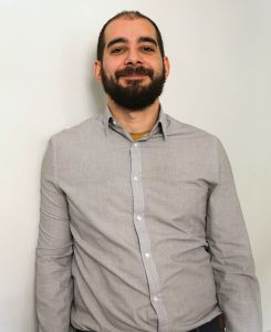
Konstantinos Mpotonakis – Geoinformatics Engineer

is currently studying at the School of Rural and Surveying Engineering and Geoinformatics of the National and Technical University of Athens, preparing his thesis in the field of InSAR technology. His main interests are in the areas of data analysis, web development, remote sensing, photogrammetry and GIS. In 2023 he completed his internship at Geosystems Hellas as a junior software developer, dealing mainly with spatial data visualization. He joined Geosystems Hellas in 2024.

Mariana Mandilara – GIS Junior Engineer

graduated from Aerospace Science and Technology of National and Kapodistrian University of Athens. Her main interests lie in the fields of remote sensing, Geographic Information Systems (GIS) and environmental data analysis. She conducted her intership in Geosystems Hellas as a remote sensing analyst in 2023 and has been working at Geosystems Hellas since 2024.

Lysander Giannikas – GIS Specialist

is a Geographer specializing in geoinformatics and area mapping. In 2003 he conducted his internship in engineering company “ANYSMA SA”. The scope of his work included digitization of elements from aerial photographs for the national land registry. He has worked in engineering and construction companies as well as the Technical Service of a Municipality. He has been working at Geosystems Hellas since 2023.

Nikos Fragkos – Junior Geospatial Engineer

is currently studying in the School of Rural, Surveying and Geoinformatics Engineering of National and Technical University of Athens. His main interests lie in the fields of earth observation and Remote sensing, photogrammetry and GIS. In 2022 he conducted his internship in Geosystems Hellas as technical staff, participating in earth observation projects and creating maps. He has been working at Geosystems Hellas since 2023.
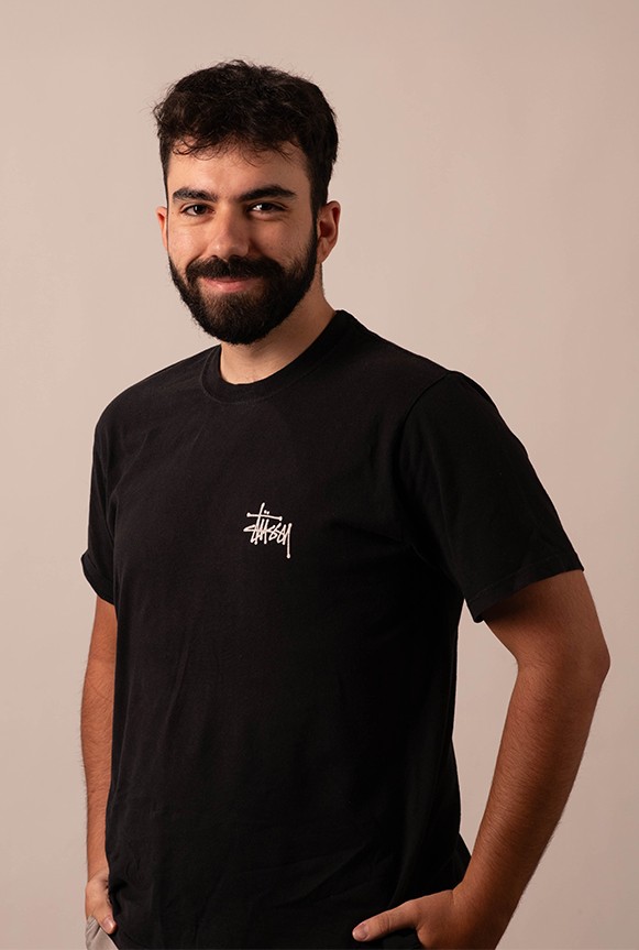
Besjan / Ioannis Bici – Geoinformatics engineer

is currently pursuing their undergraduate studies in the School of Rural, Surveying, and Geoinformatics Engineering at the National Technical University of Athens . He completed his internship in 2023 as a Remote Sensing Analyst and he possesses a strong interest in the fields of remote sensing and GIS and are dedicated to deepening their knowledge in these areas. He has been working at Geosystems Hellas since 2023.

Sofia Fidani – Sales Manager

is an agronomist with specialization in food technology. She graduated from Democritus University of Thrace in 2012 and also holds an MSc in Sustainable Management of the Environment and Natural Resources (Direction: Sustainable Management of Mountainous Watersheds with Intelligent Information Systems and GIS) from the same university. Her field of expertise and main interests lie in geoinformatic applications. Since 2014 she has been working at Geosystems Hellas as a marketing/client manager and technical support operator in geoinformatics, from 2022 working as a sales manager. 

Maria Katsikovordou – Public Relations and Communications Εxpert

is a Public Relations and Communications expert with an extensive background in Corporate and Political Communication, Media Relations & Journalism. She has worked in the private sector, in top tier Communications agencies and media networks in Athens, handled projects in Cyprus and has worked in Poland for a short time as a Journalist with Greek language, for Greek and Cyprus markets. She holds a Bachelor degree from the American College of Greece, Deree, majoring in Marketing Management, a Masters in International Public Relations from Cardiff University, School of Journalism, Media & Cultural Studies, has certifications from various seminars and workshops by Institute of International Relations, Institute of Diplomacy & Global Affairs ACG, Hellenic Institute of Communication while attended a summer School on Journalism by London School of Economics and Political Science. Maria enjoys working on multinational projects and cooperating with diverse groups of colleagues from different countries and cultural backgrounds. She believes in human aspect and emotional intelligence as a way of solving issues in today’s complex disruptive environment and trusts dialogue as a means of negotiations, conflict resolution and progress. She has been working at Geosystems Hellas since 2024

Giorgos Daskalopoulos – Communication Expert, Senior Analyst

is a Communication and Marketing Specialist. He earned his bachelor’s degree in Economic Science from Panteion University and holds a master’s degrees in Marketing from Strathclyde University in Glasgow, United Kingdom.Through work experience as a communication specialist and communication manager for two NGO’s, he specializes in creating persuasive copy for websites, emails, print advertisements, press releases as well as in using integrated digital tools such as email, social media platforms, website etc. to communicate the main purpose of the organisation. He has been working at Geosytems Hellas SA since 2023 and is responsible for the company’s communications activities.

Despina Syriopoulou

is journalist, for over 25 years -most of them based in New York City as United States correspondent for Greek media online and printed outlets. Despina worked at the private sector, both in the USA and Greece, in the field of communication, consulting, research and analysis. She holds a Bachelors degree in Ancient Greek and Latin Literature, University of Ioannina and a Masters in International Relations, New School University. She has been working for Geosystems Hellas since May 2024.

Lorem ipsum dolor sit amet, consectetur adipiscing elit. Ut elit tellus, luctus nec ullamcorper mattis, pulvinar dapibus leo.

Skip to content