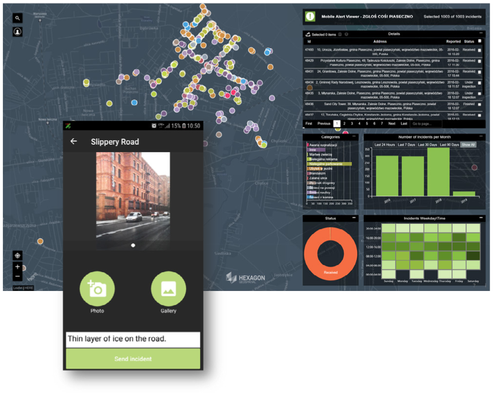
Mobile Alert is a cloud-based service that empowers mobile users to provide crowdsourced location information to subscribing organizations such as local governments or utilities.

Local government agencies and utility companies subscribe to analyze the crowdsourced information in the Mobile Alert Viewer – a dynamic Smart M.App dashboard, receive the incident notifications by email or integrate with other in-house systems through the Open Geospatial Consortium (OGC®) Web Feature Service.
Hexagon’s Geospatial division provides a total cloud-hosted solution, including the hosting environment, processing logic, and downloadable application. Citizens simply download the app for free from an app store. This straightforward app makes it easy for people to:
- Take a photo of an area
- Choose an appropriate category
- Write an optional comment
- Enter location (if GPS accuracy is poor, Bing Maps can be used to pinpoint location)
- Optionally, provide contact information for authorities to follow-up
Customize Your App
Hexagon Smart M.Apps are dynamic applications that combine content, business workflows, and geoprocessing for powerful data visualization. Two companion Smart M.Apps have been developed to complement the solid framework of the Mobile Alert system:
- Mobile Alert Configurator Smart M.App lets subscribing organizations define areas of interest, categories, email notifications, and more. All of this is done in four easy steps, with no GIS or IT knowledge required, and the configuration can be updated at any time. Mobile Alert Configurator is provided as part of the Mobile Alert Bundles.
- Mobile Alert Viewer shows real-time incident reports, pinpointing them on a map by latitude and longitude for the subscribing organization. Selecting a report will show details such as incident type, identifier, address, and comments.


