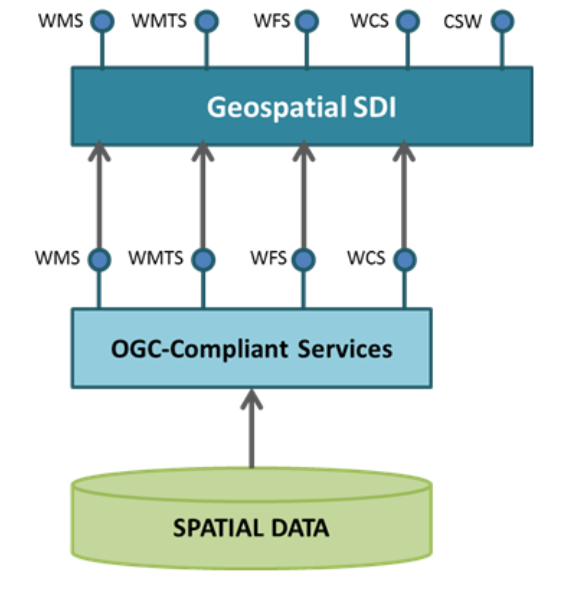
Geospatial SDI is an interoperable and scalable spatial data infrastructure designed for data providers that need to manage and serve secure or licensed information using standards-based web services. It offers powerful tools for controlled access to standards-compliant services and data published by those services, as well as tools for monitoring and reporting service performance. It ensures adherence to OGC, Infrastructure for Spatial Information in Europe (INSPIRE), and International Standards Organization (ISO) standards for web services and metadata compliance.

Features:
- Metadata standardization for easy discovery of your data – Discover information via ISO compatible directories.
- Strong, Interoperable Geospatial Data Infrastructure – Ensure alignment with the INSPIRE directive, supporting flexible diffusion of your geospatial data.
- Ease of Integration – Open interface ensuring easy integration with other Hexagon Geospatial solutions as well as third-party external services.


