ERDAS IMAGINE HEXAGON GEOSPATIAL
ERDAS IMAGINE is offered within the Producer Suite of HEXAGON GEOSPATIAL. It empowers the user to collect, process and analyze raw geospatial data and ultimately deliver usable information. This solution combines remote sensing and photogrammetric techniques, LiDAR data analysis, basic vector analysis processes and radar data processing. Optional add-ons providing specialized applications are also available to enhance your productivity and potential.
Available in three tiers:
- IMAGINE Essentials®: A powerful, low-cost image and LiDAR mapping and visualization tool that allows different types of geospatial data to be combined and quickly organized for projects. IMAGINE Essentials provides a robust set of tools for geocorrection, analysis, visualization, and map output.
- IMAGINE Advantage®: A geographic imaging toolset that extends the capabilities of IMAGINE Essentials by adding more precise mapping with sensor model support and geospatial data processing functions. The IMAGINE Advantage level allows for Point Cloud editing and includes a complete set of tools to analyze data from imagery via mosaicking, surface interpolation, radar analysis, advanced image interpretation, and orthorectification.
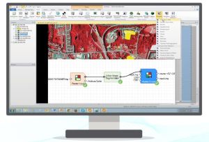
- IMAGINE Professional®: The most sophisticated software for geographic imaging, the Professional level of IMAGINE, includes complex hyperspectral image analysis, and advanced multispectral image classification and point cloud classification tools. It also includes graphical spatial data modeling, which is a unique capability for analyzing spatial data. The robust spatial modeler is a dynamic, graphical environment that provides real time feedback and previews. The modern interface includes extended analysis operators (including Point Cloud) as well as support for python scripting. Authored models can be easily run in batch or published to a server (ERDAS APOLLO WPS).
ERDAS IMAGINE 2025 (v. 16.9) Now Available
ERDAS IMAGINE is a leading advanced analysis software that combines remote sensing, spatial modeling, photogrammetry, LiDAR analysis, vector data management, and radar data processing into a single, unified product—enabling the creation of new intelligence from geospatial data.
Key New Features and Enhancements
- Faster and easier project start-up
A new template library with ready-made workflows and predefined settings allows users to quickly initiate projects by selecting workflow-specific templates. - Enhanced Spatial Modeler capabilities
The Spatial Modeler is extended with new and improved operators, including looping functionality that allows models to run until specific conditions are met. This simplifies the creation of complex, iterative models for applications such as terrain analysis or change detection over time. - Improved AI and Deep Learning performance
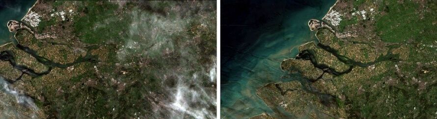
New AI libraries enhance training and classification performance, enabling faster automated feature detection (e.g., vehicles, infrastructure changes, land-use changes). Core deep learning operators have been redesigned using libTorch, reducing model training time by up to 50% compared to previous versions. - Geospatial Assist
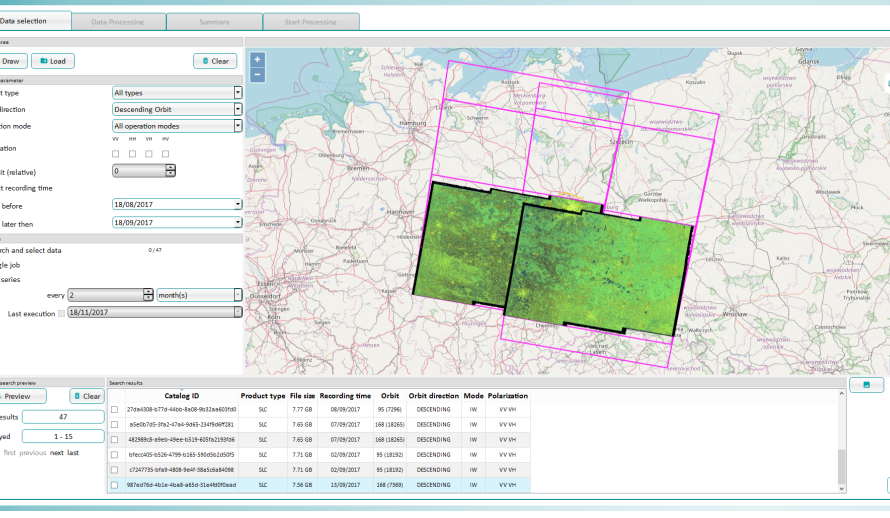
Geospatial Assist is an AI-powered assistant within the Spatial Modeler environment, designed to support the creation of spatial models. It currently accepts natural language questions and provides guidance and references for proper model design, with the future goal of generating draft spatial models automatically. - Google Earth Engine Browser*
The ERDAS IMAGINE LiveLink for Google Earth Engine has been replaced, with full functionality now integrated directly into the Spatial Modeler. Users gain access to massive data volumes and over 800 new operators, usable like any other system operator. Models can run on Google Cloud, while results are visualized locally and combined with on-premise data.
* A Google Earth Engine account is required for setup and use via the Spatial Modeler.
Geosystems Hellas, as the exclusive distributor of Hexagon’s Safety, Infrastructure & Geospatial division in Greece and Cyprus, supports you in fully leveraging the new capabilities of ERDAS IMAGINE 2025 and GeoMedia 2025—tailored to the real needs of your projects.
 Contact us at +30 210 284 6144 or sales@geosystems-hellas.gr for a presentation, demo, or more information.