ERDAS ER Mapper professional software is used worldwide in the oil, gas, and mineral exploration industries for satellite and aerial image exploitation. Working from raw data, immediately applying processing and enhancing options, and real-time response are distinctive advantages that ERDAS ER Mapper provides to users.
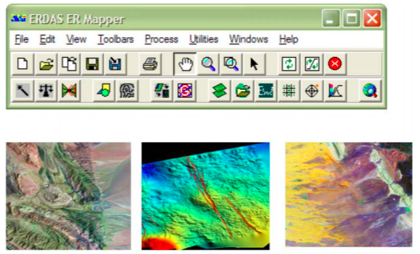
ERDAS ER Mapper technology saves time and disk space with revolutionary algorithm processing, including these features:
- Image integration platform for remote sensing and geophysical imager
- Domain-specific workflows
- Easy to use intuitive interface and wizards
- Imagery preparation tools for web data deployment
ERDAS ER Mapper provides unique geoprocessing tools for enhancing and visualizing surface interpretations, and integrating data from a variety of sources -geophysical, geochemical, satellite, digital terrain, radar, airphotos, scanned maps, vector GIS and other data- to create top quality map products.
ER Viewer
ERDAS ER Viewer a free easy-to-use desktop image viewer application and Microsoft Office Plugin, that enables you to interactively roam and zoom in JPEG 2000 and ECW files.