The recent seismic activity between Santorini and Amorgos has highlighted the need for systematic monitoring of geohazards in Greece, especially in areas exposed to earthquakes, landslides, soil erosion, subsidence, and infrastructure risks.
Geoinformatics and satellite remote sensing are essential tools for prevention, crisis management, and damage assessment.
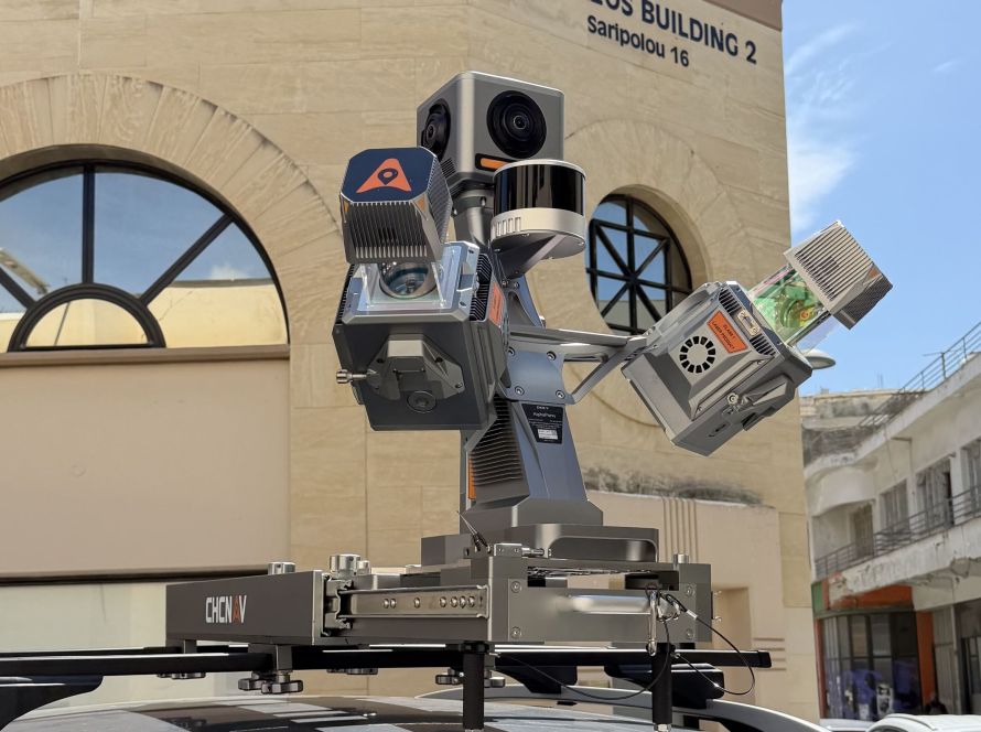
Geosystems Hellas supports this effort through advanced geospatial solutions, including SAR/InSAR satellite monitoring, GIS and WebGIS hazard maps, risk scenario modelling, and UAV/LiDAR surveys for 3D mapping and rapid damage assessment.
These technologies help authorities and infrastructure operators improve preparedness, risk reduction, and decision-making in vulnerable areas such as Santorini and the wider Cyclades region.

Additionally, we offer a holistic system for the observation, evaluation, and forecasting of ground geo-behavior and geohazard associated with the terrain and critical infrastructure, through our company’s certified portable trihedral reflector. The innovation of our solution lies in its integrated systems for temperature recording, accelerometer, GPS/GNSS antenna, and its special design compatible with the characteristics of European and modern SAR satellites. The system aims to improve the quality of SAR interferometric products for monitoring ground deformation, while the user also has access to an advanced online platform with 3D cartographic visualization functions for dynamic real-time deformation display.
Geoinformatics and Earth observation technologies are invaluable tools for the prevention and recovery of natural disasters. The ability to analyze and monitor geological and environmental parameters allows authorities and scientists to develop risk reduction strategies, prepare societies, and manage crises more effectively, ultimately saving lives and protecting infrastructure and citizens’ property.